


")
")
")

")
")

In 2025, Fieldsight takes infrastructure surveying to the next level with powerful updates across our product lineup. Our tools make surveying easier, faster, and more precise, ensuring anyone can be a surveyor and achieve high-quality results—even in the most challenging environments.
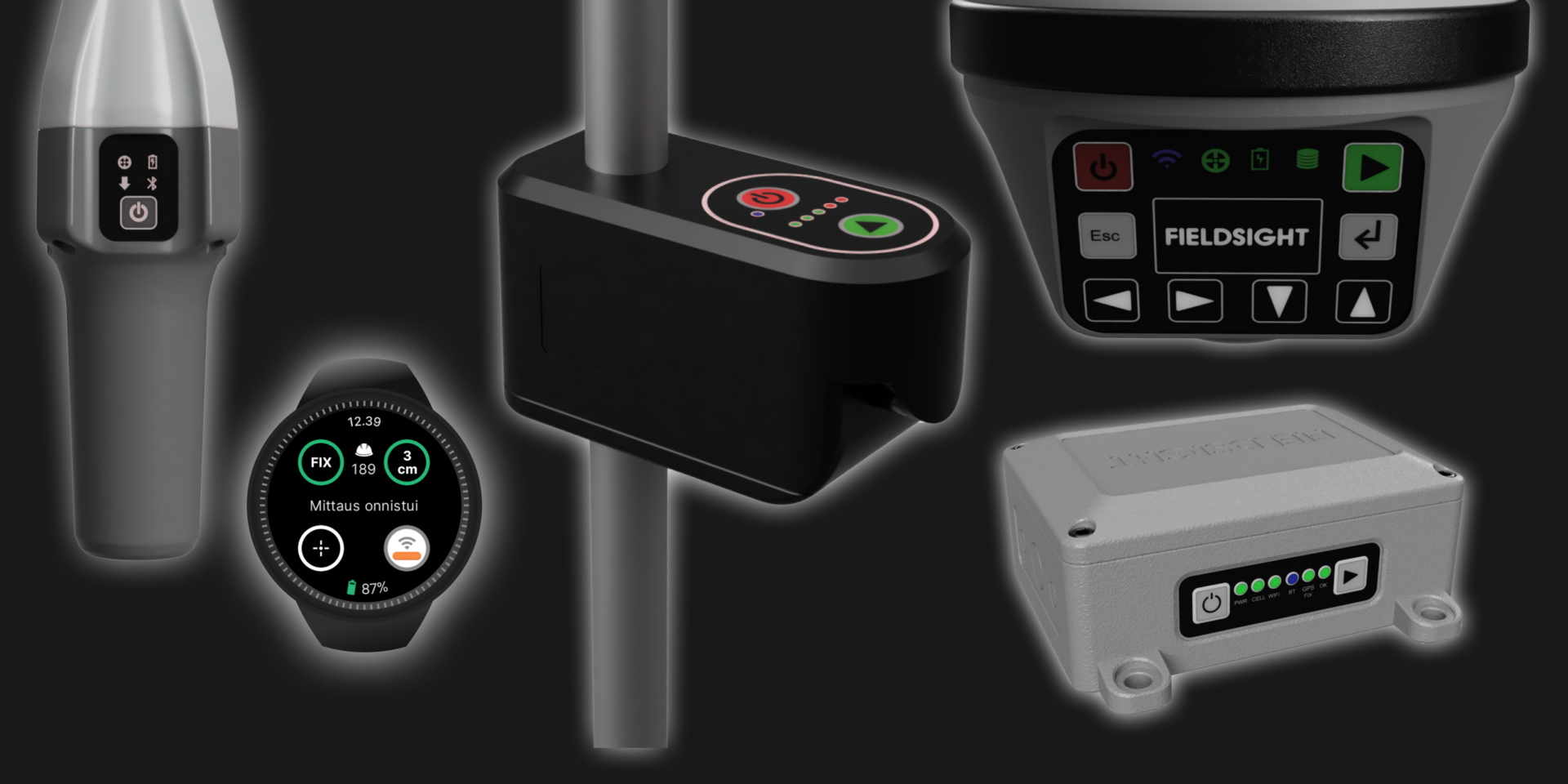
Fieldsight® GND PRO (2025)
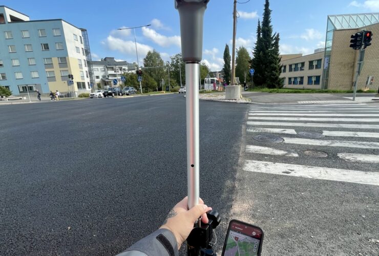
Fieldsight® GND is a multi-purpose mapping product designed for a wide range of positioning needs. It is ideal for fibre optic, asphalt and electrical network cable mapping!
2025 Updates:
- Tilt compensation up to 30° with sub-3cm precision
- New GNSS receiver with up to 1400 channels for enhanced accuracy
- Site scanning to 3D objects viewed in Fieldsight Cloud GIS
Fieldsight® GEO PRO (2025)
Fieldsight® GEO is the ideal solution for mapping in extreme weather conditions and challenging environments. It’s used with a carbon fiber gps-stick and can be upgraded with a 360° camera, depth handle, and a smartphone on a holder.
2025 Updates:
- Integrated camera for optimal image documentation to (4:3) 2590×1940 images
- New slightly slimmer design
- New high-performance antenna
- New GNSS receiver with up to 1400 channels for enhanced accuracy
- Tilt compensation up to 30° with sub-3cm precision
Fieldsight® GW (2025)
Fieldsight® GW allows for cable laying and simultaneous creation of as-built documentation. It also supports machine positioning, making it ideal for tracking and managing maintenance trains and other equipment.
2025 Update:
Support for automatic trench depth & photos using additional LiDAR

New products
Let’s take a look at the new products!
Fieldsight® Wear App
Works on Android smartwatches. A convenient way to survey and adjust objects directly from your wrist without carrying mobile phone. Perfect survey companion with GND.
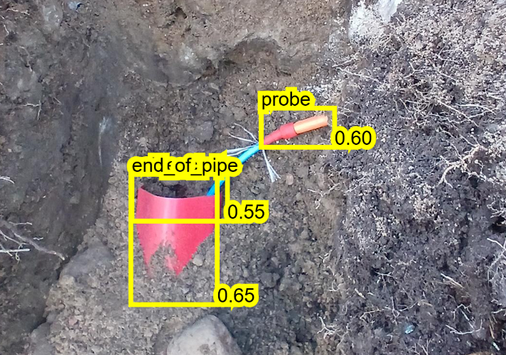
Fieldsight® LiDAR
This product enhances trench surveying by providing quick, accurate measurements and ensuring high precision with the ability to capture detailed trench profiles. Would you like to explore its features further?
- Laser scanning of trench profiles
- Automatic ground level and depth detection using algorithms
- Depth verification as-built
- Trench profiles can be supplemented with photos
Traficom M71 compliant
In our updates, we focus on external challenges, customer feedback, and global trends. Book a demo if you want to upgrade your subscription to RTK-receivers or get started with one!